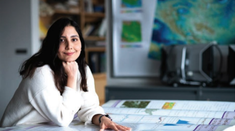
Mahboubeh Boueshagh never saw snow in her hometown in the Khuzestan Province of south- western Iran. But as a Lehigh Ph.D. student, she is deep into snow—immersed in data in the Department of Earth and Environmental Sciences’ Remote Sensing Lab. The snowpack data she examines is significant as an indicator of climate change, and it confirms a shrinking cryosphere.
The cryosphere (the word comes from the Greek kryos, which means cold, frost or ice) is “everywhere on the Earth that water is solid, like snow, lake and river ice, glaciers, permafrost, etc.,” Boueshagh explains.
Snowpacks store water during the winters and melt into the surroundings during warm weather. By measuring the snowpack variations through remote sensing, scientists like Boueshagh can help predict the climate’s impacts on water and soil.
As Boueshagh investigates how changes in snow- pack affect soil moisture and vegetation, she can relate the data to wildfire hazards in the West. “Snow can change between solid and liquid forms even with minor temperature varia- tions,” she says. “Due to climate change and global warming, the temperature has increased, resulting in the reduced snowpack, snow drought (less precipitation as snow) and earlier spring snowmelt, which means snow covers the ground for a shorter period of time. “Changes in the timing and magnitude of snowpack and snowmelt influence various components of the ecosystem like soil, water resources, plants, animals, humans, etc.,” she says. “Lower peak Snow Water Equivalent and early snowmelt cause less summer streamflow and soil moisture, downstream water stress in the summer with more water demand, changing growing seasons and intensified wildfire.”
Snow cover as a harbinger of climate change is not a new field, but it is a broadening one. Boueshagh works with a combination of remote sensing and machine learning, such as change detection, environmental modeling and predic- tion, as she did for her master’s thesis. In the lab, which is a part of the Computational and Spatial Analysis Lab, she uses different types of satellite datasets, mostly passive microwave.
Monitoring the Earth from space, passive microwave sensors detect naturally emitted microwave energy through the temperature and moisture of objects or surfaces. Monitoring the Earth in this way, says Boueshagh, “is spatially and temporally helpful in studying the environ- ment.” There are different publicly available remote sensing datasets with different spatial and temporal resolutions, including active and passive microwave, lidar and optical, that researchers can choose based on their goals and case study. “For example,” she says, “I can use optical data to estimate snow cover area and micro- wave data to derive snow depth and Snow Water Equivalent. There are in-situ measure- ments available to validate estimations from remote sensing and calibrate models.
Excerpt from Acumen, Spring 2023. See full article here.